These maps will allow you to see the real size of the countries of the world
Categories: World
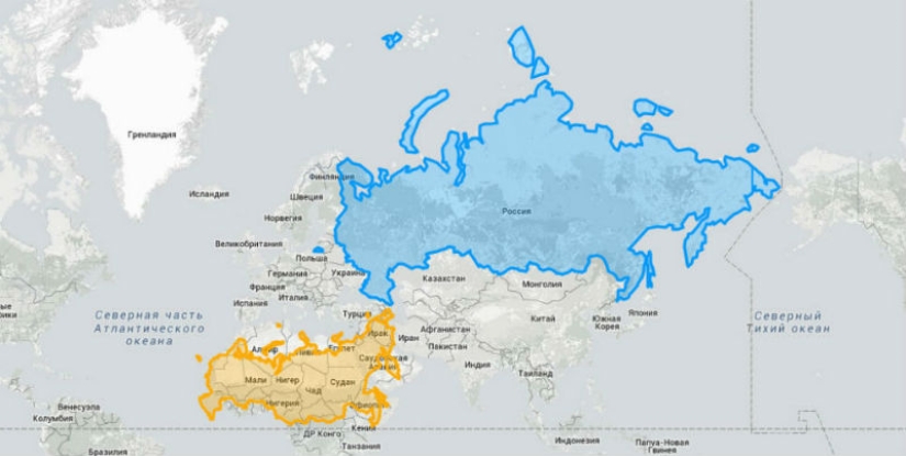
By Pictolic https://pictolic.com/article/these-maps-will-allow-you-to-see-the-real-size-of-the-countries-of-the-world1.htmlThe reason why some countries look bigger or smaller on the map is because of the Mercator projection. Putting a three-dimensional planet on a flat map was something of a challenge for the pioneers of modern cartography, and the Flemish geographer Gerard Mercator invented a way to cope with this task.
 Source: boredpanda.com
In 1569, Mercator created a map that was quite suitable for use for navigation purposes, but its significant drawback was that the system he invented distorted the size of objects depending on their position relative to the equator. Because of this, parts of the land, such as Antarctica or Greenland, located much closer to the poles, looked significantly larger than their real size.

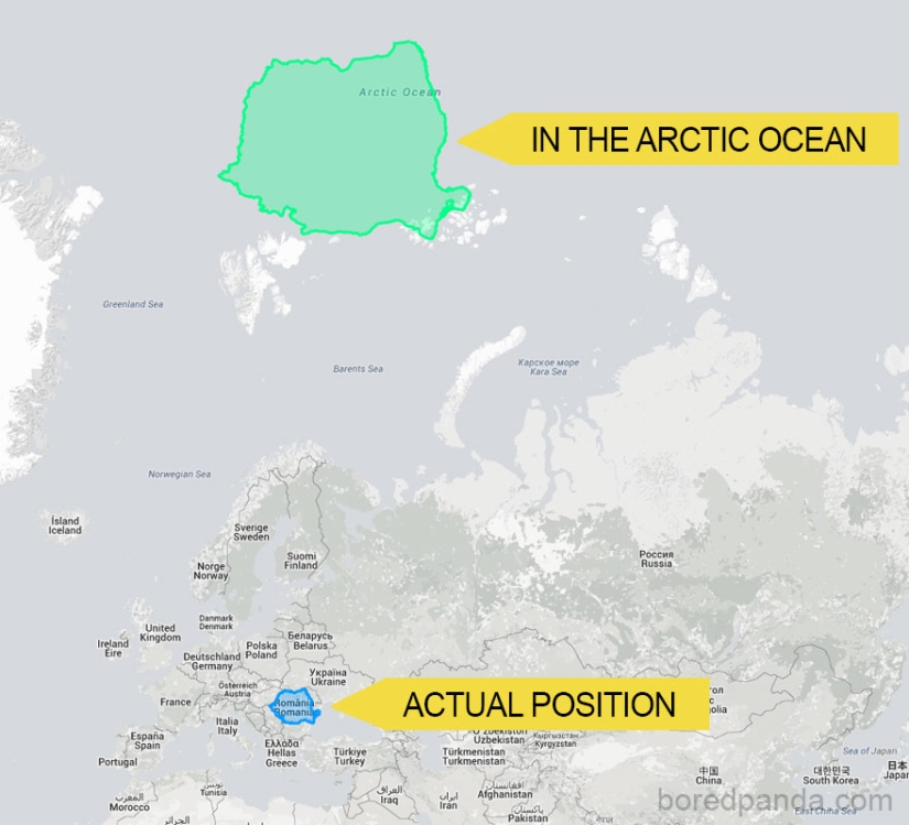
For example, according to Mercator's projection, Romania would be a huge island in the Arctic Ocean.
In order to demonstrate how much our idea of the size of countries and continents is wrong due to the use of this system, the creators of the site thetruesize.com they made it possible for any user to move the territories of countries on the surface of the Earth for visual comparison.
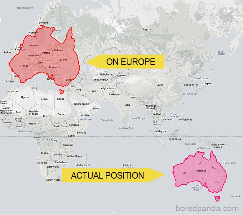
If Australia were located in the place of Europe.
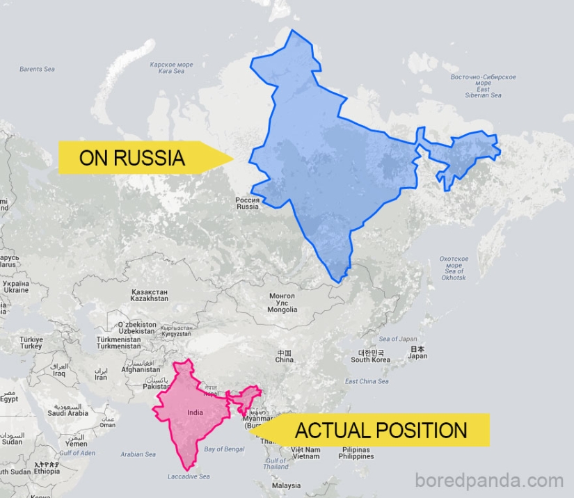
If India were in Russia's place.
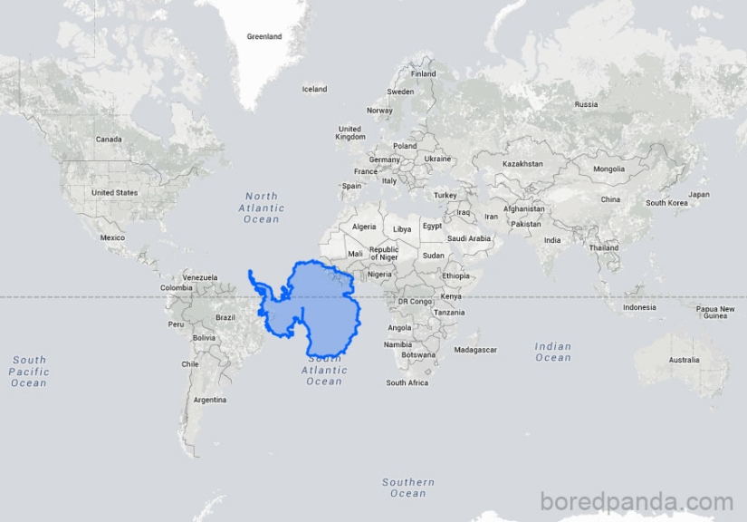
Antarctica is quite comparable in size to Brazil.
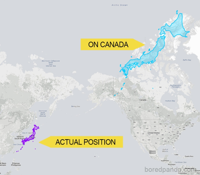
Japan would stretch across Canada.
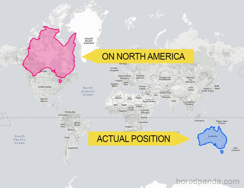
Australia in North America.
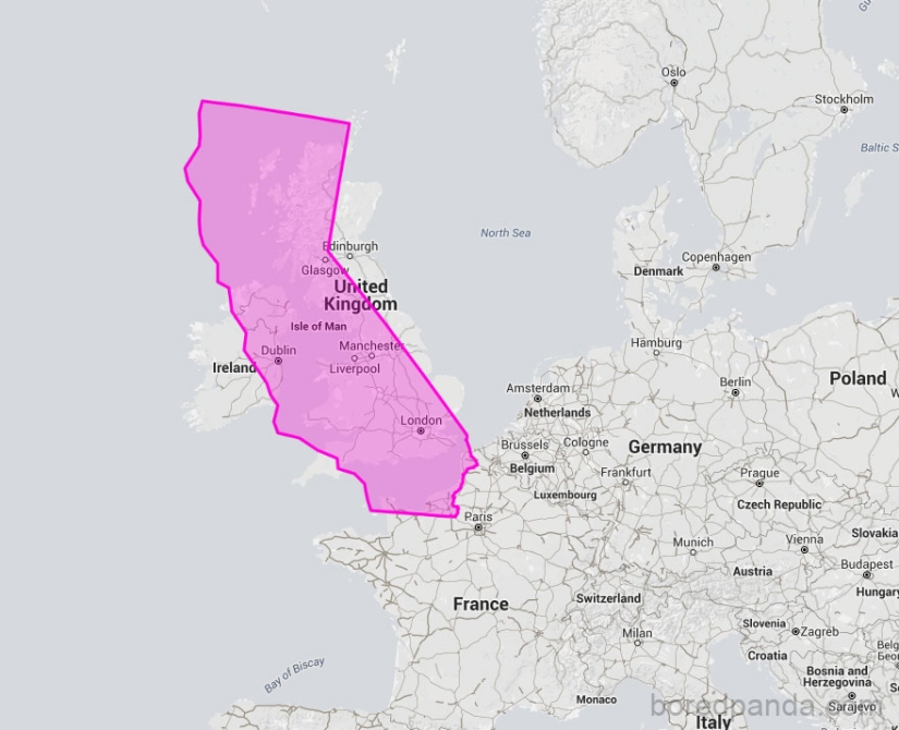
California is comparable in size to the UK.
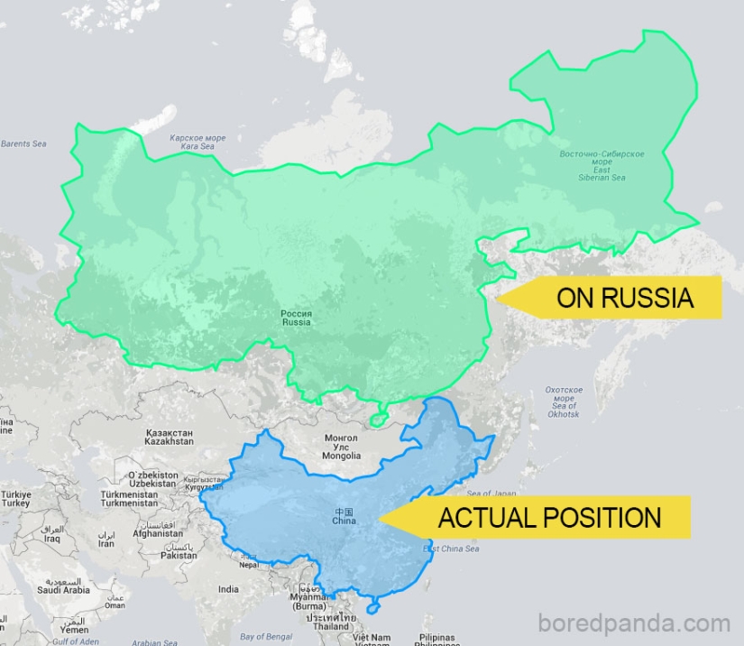
If China were in Russia's place.
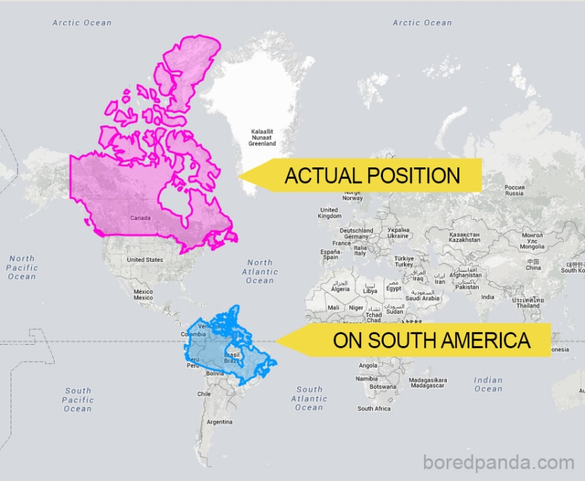
Canada is not so huge if you move it to South America.
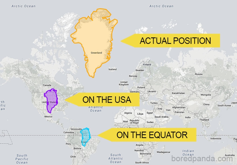
A fun journey of Greenland on the world map.
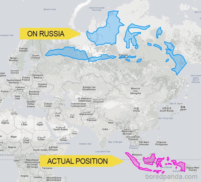
If Indonesia were located closer to the North Pole, it would be comparable in length to the territory of Russia.
Brazil in Asia would look like a giant.
Keywords: Geography | Map | Maps | Continent | Planet earth | Size | Comparison | Countries
Post News ArticleRecent articles

It's high time to admit that this whole hipster idea has gone too far. The concept has become so popular that even restaurants have ...

There is a perception that people only use 10% of their brain potential. But the heroes of our review, apparently, found a way to ...
Related articles

Idea guy from Instagram "travels" around the world, exploring the map, virtual globe Google Earth. He finds interesting and ...

The creation of these maps from food by Caitlin Levin and Henry Hargreaves was inspired by a passionate desire to travel. Exploring ...

These maps tell you about the world a lot about what you didn't know! --> Distribution of wolves in Italy, 1900 — 2020 Nesting ...

New Year's is a time to surprise and delight loved ones not only with gifts but also with a unique presentation of the holiday ...