Satellite, tilt the camera: Photos from Space that don't look like Google Maps
Categories: Aerophoto | Nature
By Pictolic https://pictolic.com/article/satellite-tilt-the-camera-photos-from-space-that-dont-look-like-google-maps.htmlFew people today still believe that the Earth is flat. However, this is exactly what can be assumed by viewing satellite images of the Earth taken at nadir — when the camera looks exactly down at an angle of 90 degrees.
The traditional way of vertical shooting hides details, smoothing out mountains, waterfalls and skyscrapers so that what we see looks more like a map than a photograph.
This experimental series of satellite images taken from an angle allows you to open the perspective and see the natural and urban area in a new way.
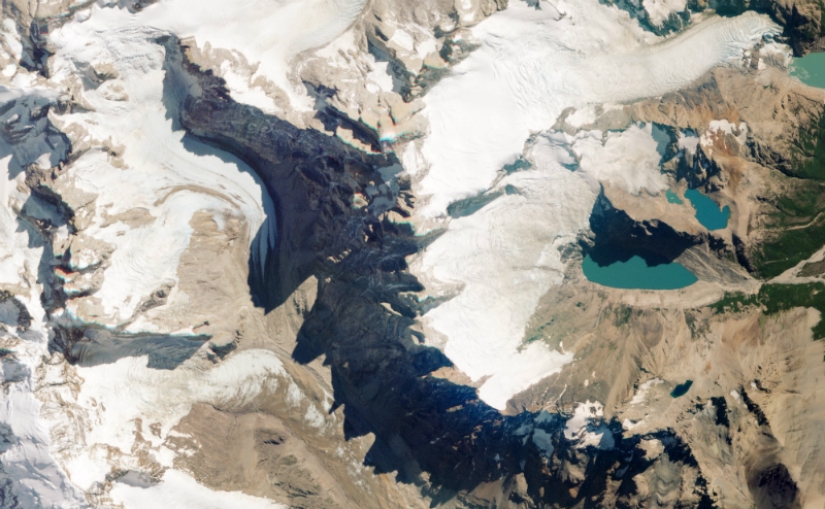 Take the famous Mount Fitzroy on the border of Argentina and Chile - you won't immediately understand what exactly is in the picture until you see a hint in the toothy shadows cast by the rocky peaks.
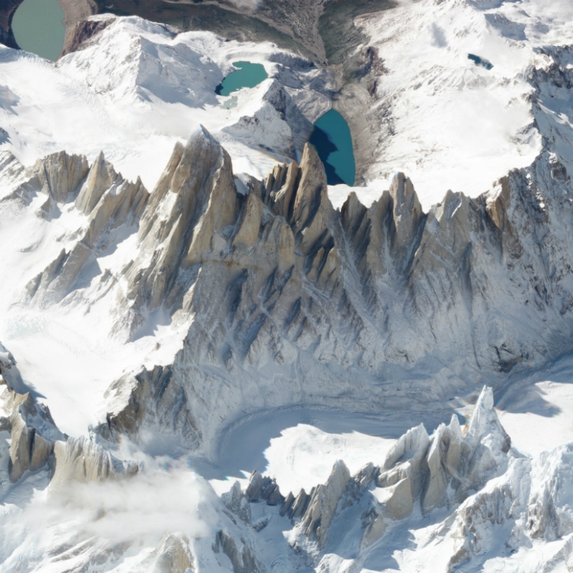 A picture taken from a different angle changes the perspective: the image instantly becomes three-dimensional - mountains gain height, and valleys - depth. It's like looking out the window of an airplane from a height of 450 km.
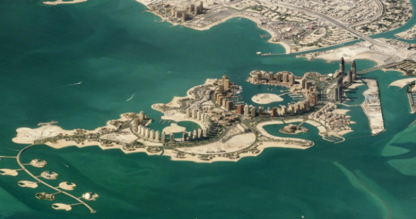
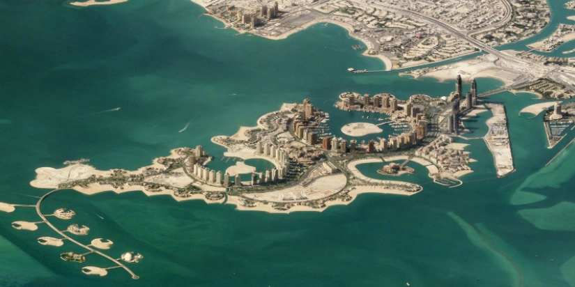 Doha, Qatar. The pearl of Qatar is an artificial island in the shallow waters of the Persian Gulf.
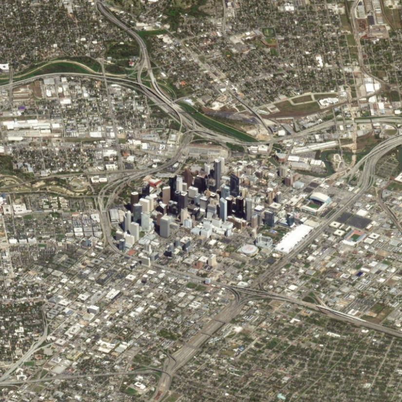 Houston, USA. The picture shows what an insignificant part of the city's territory is an island with skyscrapers.
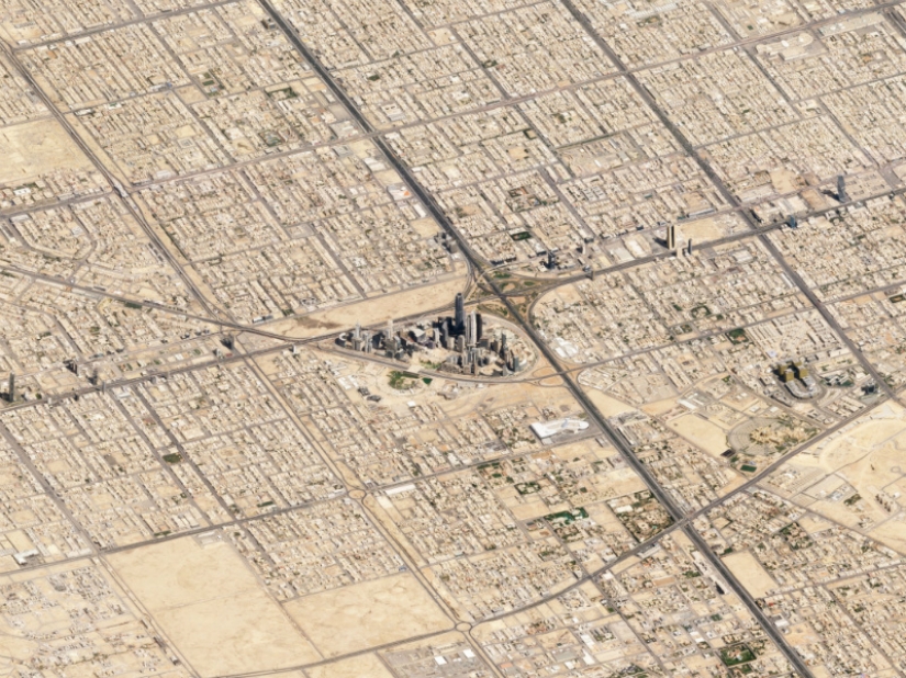 Riyadh — Saudi Arabia. On the example of Riyadh, this can be seen even better (the air is not so humid, so you can get a clear picture with more coverage).
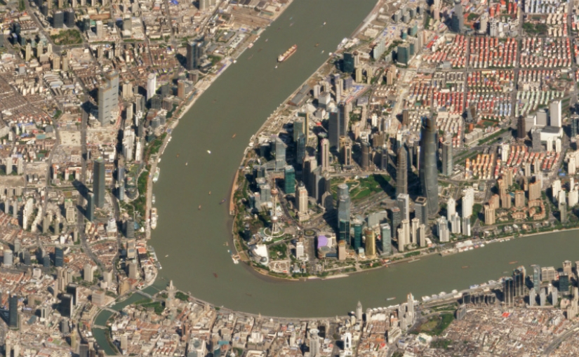 Shanghai, China.
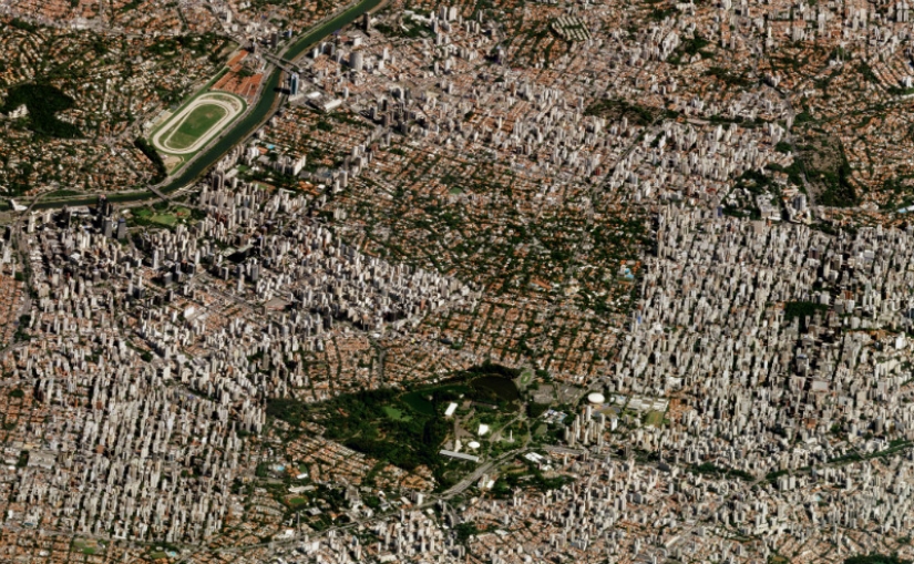 Sao Paulo, Brazil is the most populated city in the Western Hemisphere.
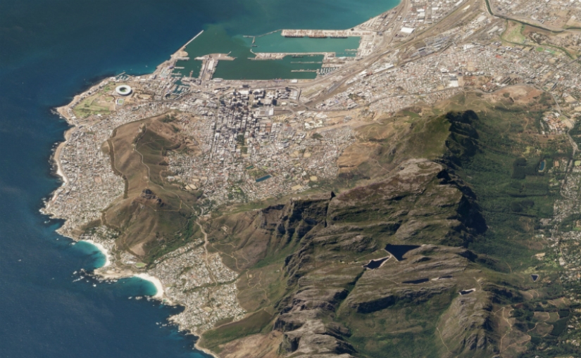 Table Mountain looms over Cape Town, South Africa.
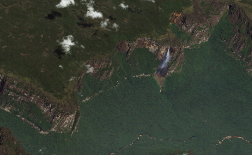 The highest Angel Waterfall in the world is 979 m .
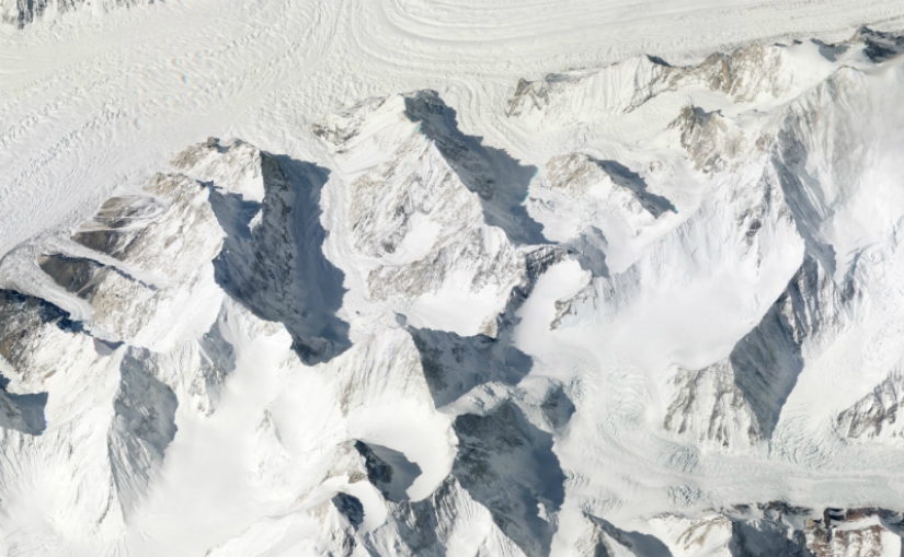 Karakoram Ridge, Pakistan. The picture shows all three peaks - Gasherbrum I (8068 m), Broad Peak (8047 m) and Gasherbrum II (8035 m).
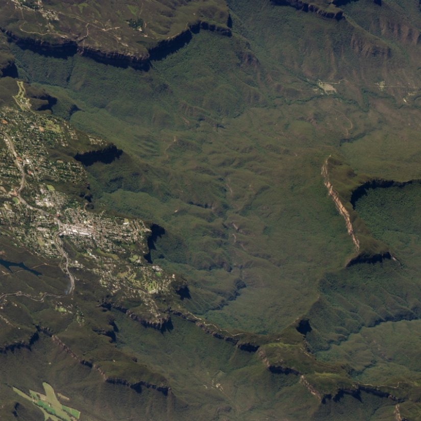 Blue Mountains, Australia.
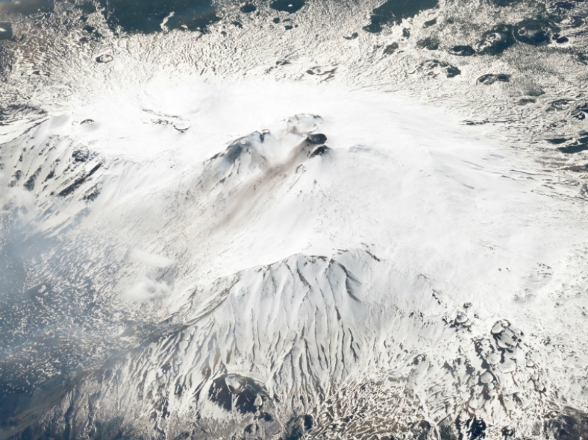 Etna is the second most active volcano in the world, Italy.
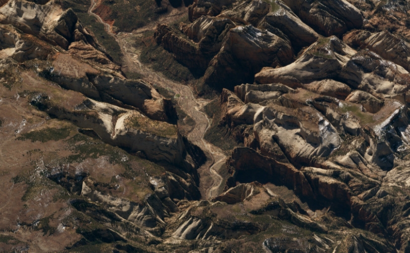 Zion National Park, Utah, USA.
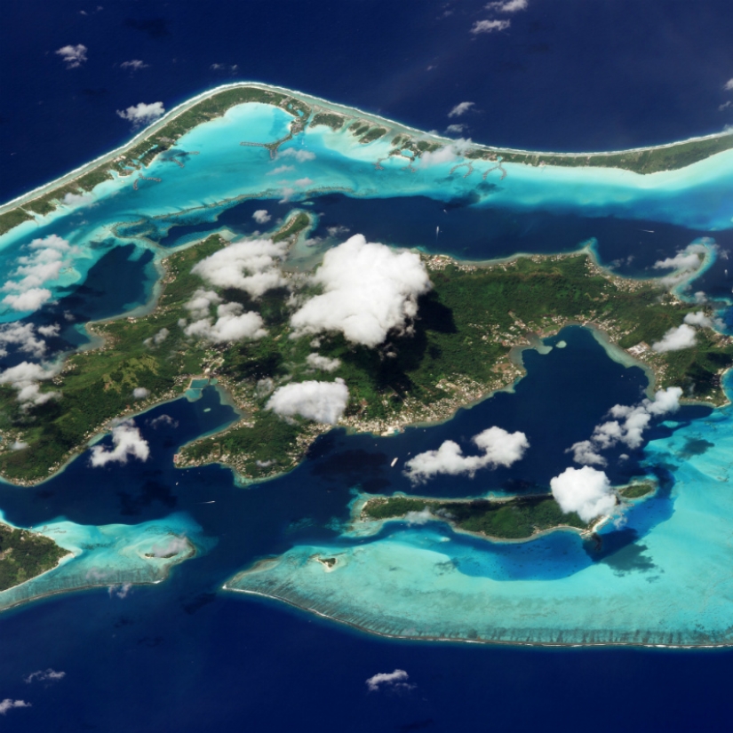 Bora Bora, Tahiti.
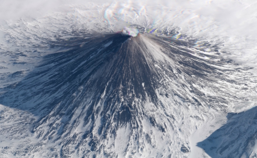 Klyuchevskaya Sopka volcano, Kamchatka, Russia. Due to periodic emissions of ash and gas, flights over Kamchatka are often redirected.
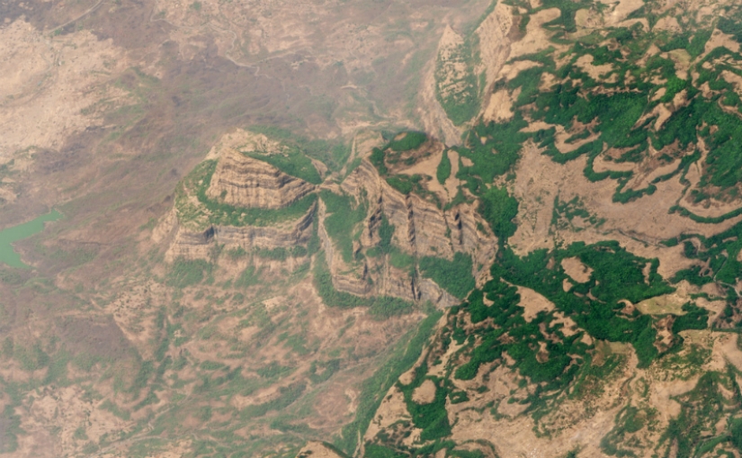 The Deccan Traps in India are one of the largest volcanic formations on earth, consisting of basalt deposits 2000 meters thick.
Keywords: Aerial photography | Cities | Planet | Snapshots | Photos
Post News ArticleRecent articles

Contrary to the prevailing opinion that a tattoo is almost an antisocial mark, which is a distinctive feature of people who have ...

The human hand is a complex mechanism consisting of many elements. But it happens that due to genetic disorders these parts of the ...
Related articles

Idea guy from Instagram "travels" around the world, exploring the map, virtual globe Google Earth. He finds interesting and ...

Tommy Lundberg (Tommy Lundberg), a famous photographer and Illustrator from Los Angeles, California, which shoots people, nature, ...

The life of people on other planets no longer seems like a perfect fantasy, as a few decades ago. Space exploration is being ...

Almost every person has ever noticed images around him that do not exist in reality: the outlines of faces, hearts or animals. ...